
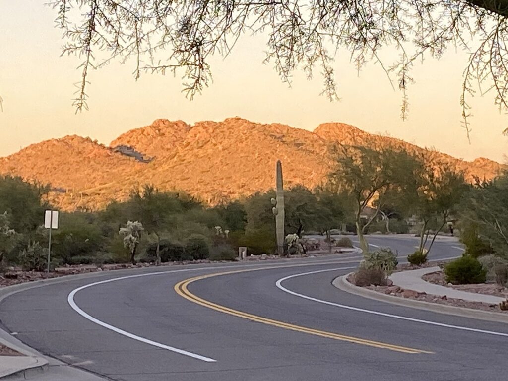
America’s national parks offer some of the most breathtaking landscapes in the world, and there’s no better way to experience their grandeur than on a scenic drive. From winding mountain roads to coastal highways, these routes provide accessible adventures for travelers of all abilities.
Each drive tells a unique story of America’s diverse geography, showcasing everything from ancient redwoods to desert formations sculpted over millions of years. Pack your camera, prepare some snacks, and join us as we explore the most spectacular scenic drives through America’s iconic parklands, where every turn reveals another postcard-worthy vista.
Going-to-the-Sun Road: Glacier National Park’s Engineering Marvel
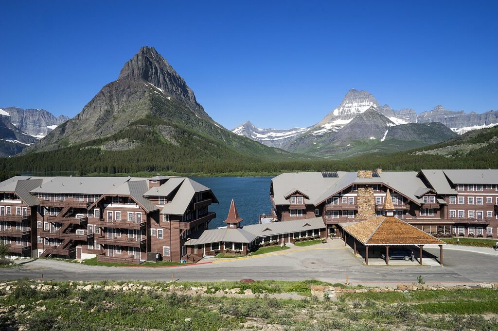
Cutting through the heart of Montana’s Glacier National Park, the Going-to-the-Sun Road remains one of America’s most spectacular engineering achievements. This 50-mile thoroughfare climbs to an elevation of 6,646 feet at Logan Pass, delivering travelers past glacial lakes, dense forests, and alpine meadows bursting with wildflowers during summer months. Construction of this mountain highway was completed in 1932 after nearly two decades of intensive labor, with workers often suspended by ropes to carve the passage through seemingly impassable terrain.
The road is typically open from late June to mid-October, weather permitting, as winter snowfall can accumulate to depths exceeding 80 feet in some areas. For the best experience, consider taking the park’s free shuttle service, which allows you to focus entirely on the breathtaking vistas rather than navigating the occasionally nerve-wracking hairpin turns.
Trail Ridge Road: Rocky Mountain National Park’s Path Through the Clouds
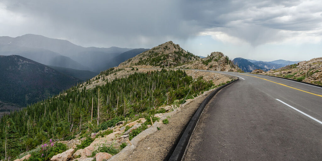
As America’s highest continuous paved road, Trail Ridge Road in Colorado’s Rocky Mountain National Park offers an unparalleled alpine experience that stretches 48 miles between Estes Park and Grand Lake. Reaching a maximum elevation of 12,183 feet, this highway spends over 10 miles above the tree line, where the harsh environment creates a unique tundra ecosystem that’s typically found only in the Arctic.
Completed in 1932, the road follows ancient paths used by Native American hunters who traversed these heights for thousands of years before European settlement. Wildlife sightings are common along this route, with elk, bighorn sheep, and yellow-bellied marmots frequently visible grazing near the roadside. During your drive, be sure to stop at the Alpine Visitor Center, which sits at 11,796 feet and offers educational exhibits about the fragile tundra environment surrounding you.
Tioga Road: Yosemite’s High-Country Passage
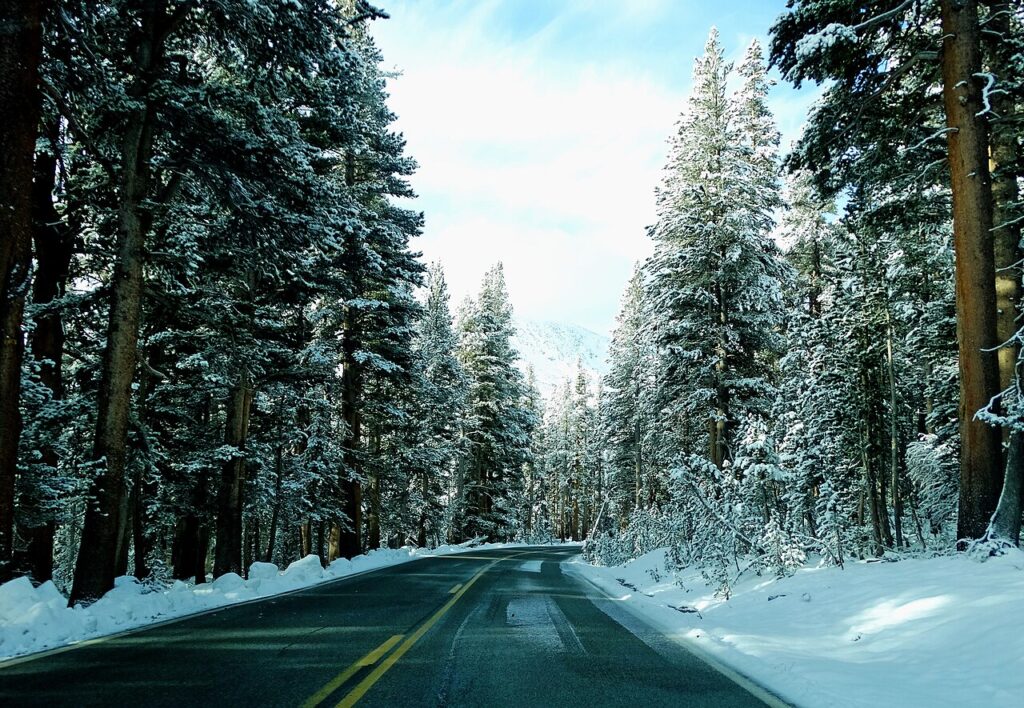
Tioga Road provides access to Yosemite National Park’s less-visited but equally spectacular high country, cutting through granite wonderlands and subalpine meadows across the Sierra Nevada. This 47-mile scenic byway typically opens in late May or June after snow removal crews clear the substantial winter accumulation, sometimes requiring walls of snow reaching 20 feet high to be cleared. The road’s history dates back to 1883 when it was constructed as a mining access route before being incorporated into the park and rebuilt in the 1930s as part of Depression-era public works projects.
Olmsted Point offers one of the drive’s most spectacular vistas, with sweeping views of Half Dome from an entirely different perspective than the more familiar valley floor viewpoints. At 9,945 feet, Tioga Pass marks the eastern entrance to Yosemite and is the highest automobile pass in California, offering breathtaking views before descending toward the stark beauty of Mono Lake.
Desert View Drive: Grand Canyon’s Eastern Panoramic Route
Tracing the South Rim of one of nature’s most awe-inspiring creations, the 25-mile Desert View Drive offers numerous opportunities to appreciate the Grand Canyon’s immensity from different perspectives. Unlike the more crowded central visitor areas, this eastern stretch provides a more contemplative experience with six developed viewpoints and several unmarked pullouts where you can often enjoy the scenery in relative solitude. The drive culminates at the historic Desert View Watchtower, a 70-foot stone structure designed by pioneering female architect Mary Colter in 1932, incorporating Indigenous design elements and offering panoramic views of the canyon’s painted desert and the distant Painted Desert.
Archaeological evidence visible from parts of the drive reveals that humans have been visiting and living around the canyon for nearly 12,000 years, creating a profound connection between the landscape and human history. During your journey, keep an eye out for California condors, the largest North American land bird, which was reintroduced to the area after near extinction and can occasionally be spotted soaring on thermal currents rising from the canyon walls.
Cadillac Summit Road: Acadia’s Path to the Atlantic Dawn
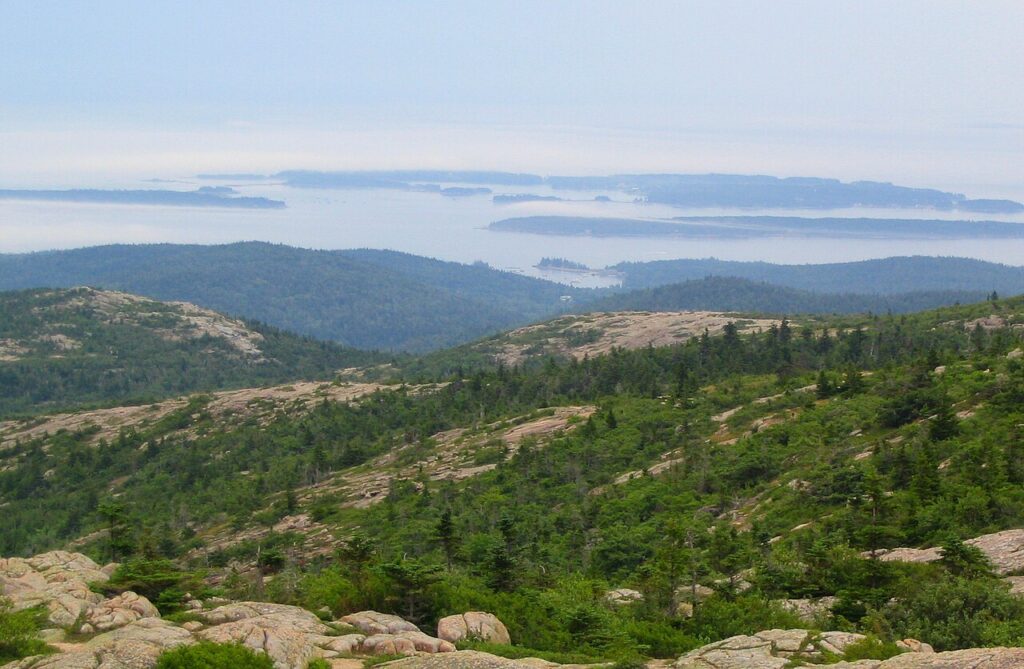
Winding its way to the top of the highest peak on the North Atlantic seaboard, the Cadillac Summit Road in Maine’s Acadia National Park offers a relatively short but unforgettable 3.5-mile ascent. The summit of Cadillac Mountain, at 1,530 feet, is the first place in the United States to see sunrise for much of the year, making pre-dawn drives particularly popular among photographers and early risers seeking a transcendent natural experience. Originally designed in the 1920s as part of John D. Rockefeller Jr.’s network of carriage roads, the paved motor road maintains the original vision of harmonizing human access with natural beauty through careful design that respects the landscape.
From the summit, visitors enjoy a 360-degree panorama encompassing Bar Harbor, the Porcupine Islands, and on clear days, views extending to Mount Katahdin over 100 miles away. The pink granite that forms much of the mountain catches the early morning light in spectacular fashion, creating a rosy glow that has inspired painters and photographers for generations.
Loop Road: Cades Cove’s Window to Appalachian Heritage
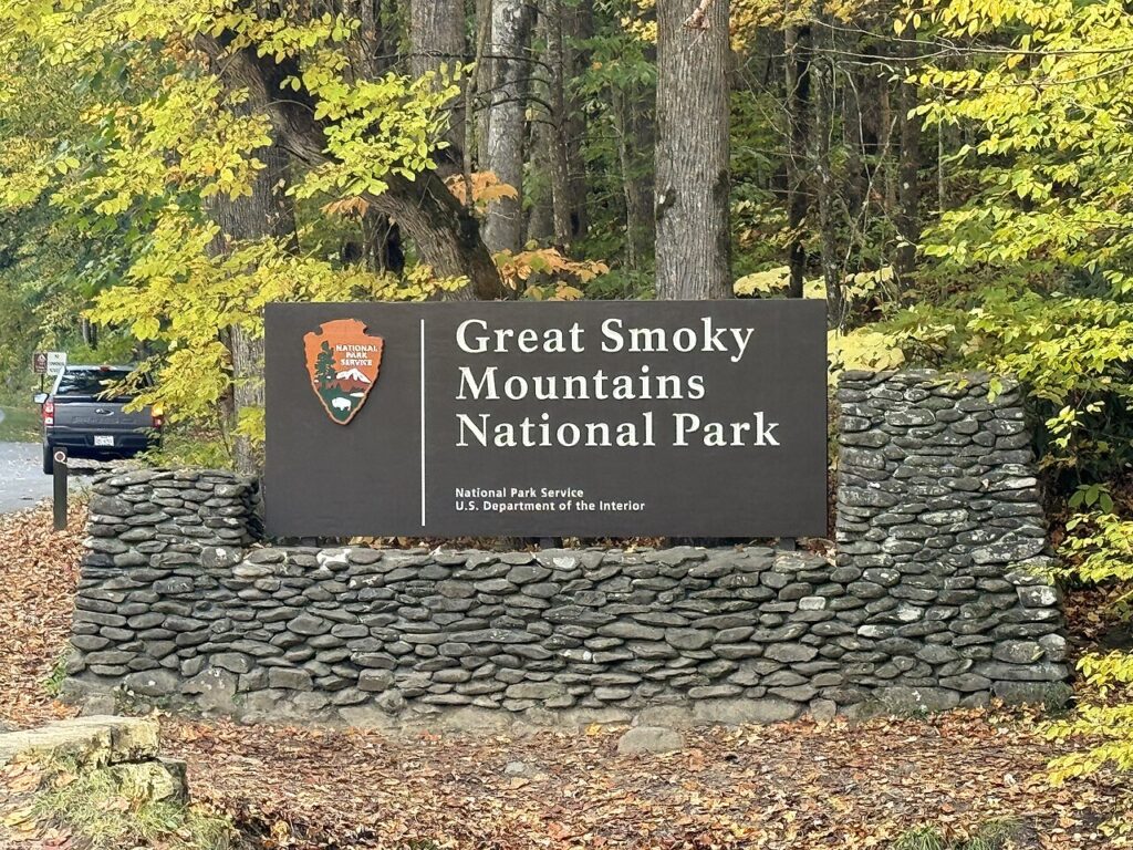
The 11-mile one-way Loop Road through Cades Cove in Great Smoky Mountains National Park offers a journey through both natural splendor and American history. This broad, verdant valley surrounded by mountains was home to Cherokee hunters for thousands of years before European settlers established farms in the early 19th century, leaving behind historic structures that the National Park Service now preserves. The drive features three churches, a working grist mill, and several restored homesteads that provide a glimpse into the challenging yet rewarding life of Appalachian settlers before the park’s establishment in 1934.
Wildlife viewing opportunities abound, with white-tailed deer frequently visible in meadows and black bears occasionally spotted foraging at forest edges, particularly in early morning or late evening hours. The valley’s relatively flat terrain is surrounded by mountain peaks, creating a natural amphitheater that often fills with morning mist, lending the Smokies their name and creating ethereal photographic opportunities for early risers.
Pierce Stocking Scenic Drive: Sleeping Bear Dunes’ Coastal Showcase

Named after the local lumberman who created it, the 7.4-mile Pierce Stocking Scenic Drive guides visitors through diverse ecosystems within Michigan’s Sleeping Bear Dunes National Lakeshore. The carefully designed route takes travelers through beech-maple forests, past ancient sand dunes, and to overlooks perched 450 feet above the stunning blue waters of Lake Michigan. At the Lake Michigan Overlook, visitors encounter a breathtaking view of the lake from atop a steep sand bluff, where the massive dunes appear to flow directly into the water, creating one of the most photographed landscapes in the Midwest.
The drive includes twelve numbered stops with interpretive signs explaining the geological forces that created this unique landscape, including the advance and retreat of massive glaciers that sculpted the Great Lakes basin approximately 12,000 years ago. Open from spring through fall, the drive offers dramatically different experiences throughout the seasons, from spring wildflowers carpeting the forest floor to the spectacular autumn foliage that transforms the hardwood forests into a kaleidoscope of red, orange, and gold.
Park Loop Road: Acadia’s Greatest Hits Tour
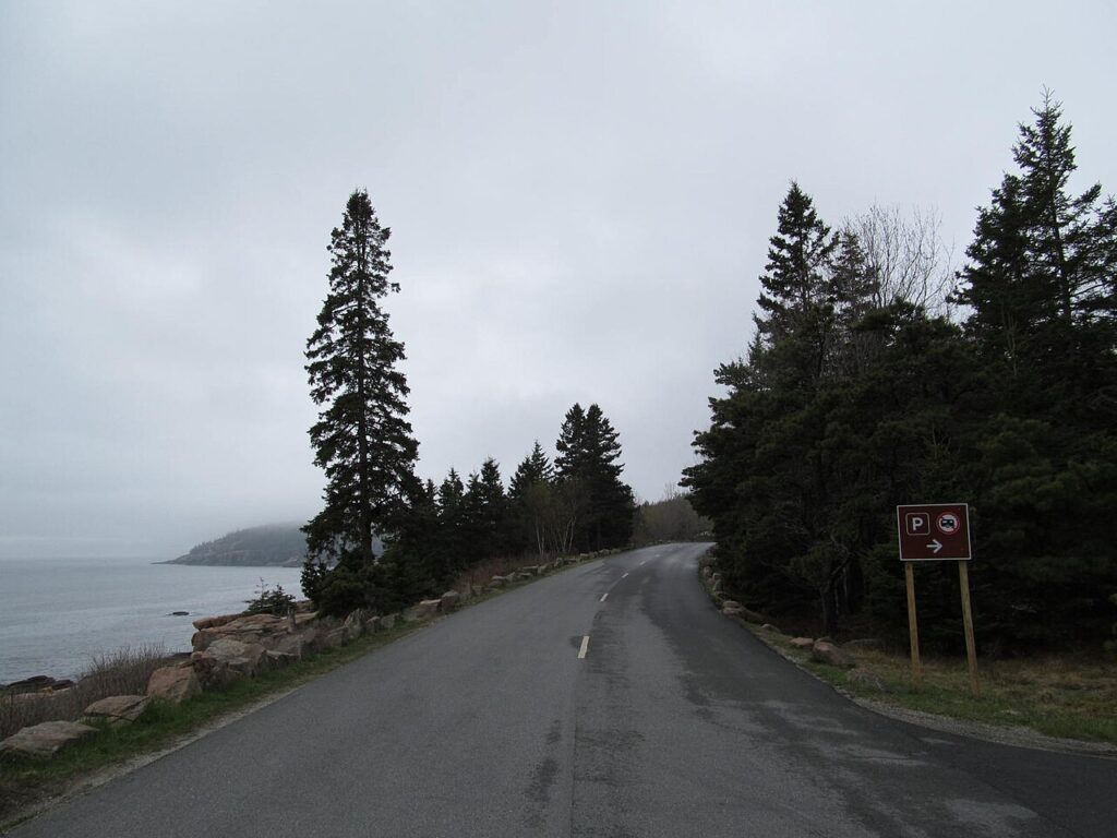
Complementing the previously mentioned Cadillac Summit Road, Acadia National Park’s 27-mile Park Loop Road serves as the primary thoroughfare connecting the park’s most celebrated natural features. This thoughtfully designed roadway hugs the eastern shore of Mount Desert Island, alternating between dense forests, rocky headlands, and dramatic coastline where Atlantic waves crash against pink granite shores. The road provides access to popular destinations including Sand Beach, the only true sand beach on the island; Thunder Hole, where waves create thunderous booms as they compress air in a natural rock chamber; and the elegant stone bridges commissioned by philanthropist John D. Rockefeller Jr., who donated much of the land that became Acadia.
One particularly remarkable section known as Ocean Drive follows the coastline for about two miles, with numerous pull-offs allowing visitors to explore tide pools, watch peregrine falcons nesting on cliff faces, or simply contemplate the meeting of land and sea. The road is partly one-way, creating a natural flow that helps visitors progressively experience the diverse environments that make Acadia one of America’s most beloved coastal parks.
Generals Highway: Connecting Giant Sequoia Groves
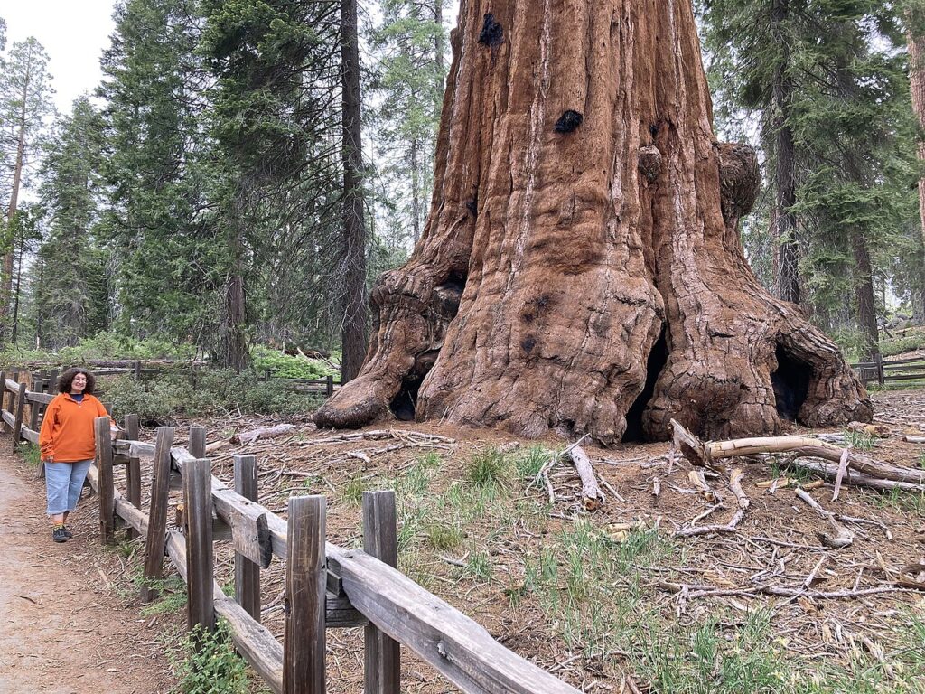
Linking Sequoia and Kings Canyon National Parks in California, the 80-mile Generals Highway guides travelers through groves of the world’s largest trees, creating an experience that must be felt to be truly understood. Named after the famous named trees along its route—including General Sherman, the largest tree on Earth by volume—this mountain road climbs from 1,700 to over 7,000 feet in elevation, passing through multiple ecological zones from chaparral to subalpine forest. Construction began in 1926 as part of the early development of national park infrastructure, with Civilian Conservation Corps workers completing significant portions during the Great Depression.
The highway features numerous pull-outs where visitors can marvel at sequoias that have stood for over 2,000 years, surviving countless forest fires, climate changes, and the rise and fall of human civilizations. A particularly memorable stretch passes through Giant Forest, home to five of the ten largest trees in the world, where specialized parking areas allow visitors to walk among these ancient beings whose massive trunks, some exceeding 30 feet in diameter, create a cathedral-like atmosphere in the dappled sunlight.
Blue Ridge Parkway: America’s Longest Linear Park
Stretching 469 miles along the spine of the Blue Ridge Mountains from Virginia to North Carolina, the Blue Ridge Parkway represents one of America’s greatest roadway achievements and connects Shenandoah National Park with Great Smoky Mountains National Park. Construction began in 1935 as a Depression-era public works project, though the final section wasn’t completed until 1987, creating what has been called “America’s Favorite Drive” with its carefully designed vistas, graceful curves, and absence of commercial development. Engineers and landscape architects collaborated to create a road that appears to have grown organically from the mountainsides, with stone guardrails, tunnels carved through ridges, and bridges that complement rather than dominate their natural settings.
The parkway passes through six mountain ranges, crosses numerous rivers, and spans elevations from 649 to 6,053 feet, creating microclimates that support extraordinary biodiversity, including over 1,600 plant species and some of the richest salamander diversity on Earth. Fall brings spectacular foliage displays as different elevations change color in progressive waves, while spring features stunning wildflower blooms including trillium, lady slipper orchids, and flame azaleas that create carpets of color along the roadside.
Zion-Mount Carmel Highway: Engineering Through Red Rock Country

The 25-mile Zion-Mount Carmel Highway and its famous 1.1-mile tunnel represent one of the most ambitious engineering projects ever undertaken in a national park, connecting the main canyon of Zion National Park with the park’s eastern plateaus. Completed in 1930 at the then-enormous cost of $503,000, the tunnel was excavated through solid sandstone and features “galleries”—openings in the canyon wall that provide both ventilation and spectacular views for travelers passing through. The highway climbs nearly 800 feet via a series of six switchbacks known as “the zigzags” before entering the east side of the park, where the landscape transforms from towering red cliffs to fascinating rock formations including Checkerboard Mesa, named for its distinctive crosshatched erosion pattern.
The entire route offers breathtaking views of colorful sandstone layers representing over 150 million years of geological history, with colors ranging from cream to pink to vermilion. Wildlife sightings are common along this drive, with desert bighorn sheep frequently spotted on the steep canyon walls and the endangered California condor occasionally seen soaring overhead, their impressive 9.5-foot wingspans casting shadows on the ancient rocks below.
Paradise Valley Road: Mount Rainier’s Wildflower Wonderland
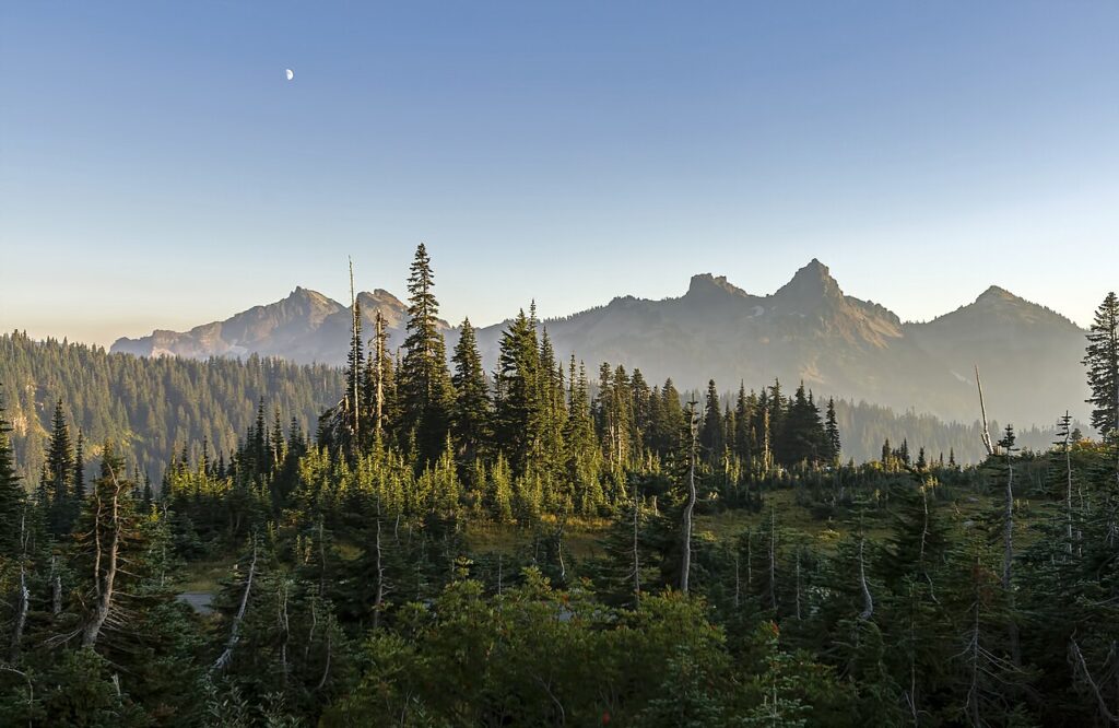
Leading to the aptly named Paradise region of Mount Rainier National Park in Washington, the Paradise Valley Road climbs from dense temperate rainforests to subalpine meadows renowned for their spectacular wildflower displays. The 15-mile route begins at the Nisqually Entrance and ascends more than 5,400 feet to Paradise, which at 5,400 feet sits on the southern slope of the massive volcano whose summit looms another 8,900 feet above.
During the peak blooming season from late July through August, the meadows burst into a kaleidoscope of colors with lupine, paintbrush, beargrass, and dozens of other species creating natural gardens that inspired the area’s name when pioneer James Longmire’s daughter-in-law exclaimed “Oh, what a paradise!” upon first seeing the meadows in 1885.
The road offers numerous viewpoints of Mount Rainier, the most glaciated peak in the contiguous United States with 25 named glaciers covering approximately 35 square miles of the mountain’s surface. The historic Paradise Inn, a rustic lodge built in 1916 primarily from materials found within the park, stands at the end of the road, offering visitors a classic national park lodging experience with hand-hewn beams and massive stone fireplaces where generations of travelers have warmed themselves after exploring the mountain’s slopes.
Planning Your National Park Scenic Drive Adventures
When planning your scenic drives through America’s national parks, timing considerations can significantly enhance your experience, with shoulder seasons (late spring and early fall) often providing ideal conditions with fewer crowds and moderate weather. Many high-elevation roads close during winter months due to snow, so checking current road conditions through the National Park Service website or visitor centers is essential before embarking on your journey.
Wildlife viewing is typically best during early morning or late afternoon hours when animals are most active, so planning your drives around these times can significantly increase sighting opportunities. Consider purchasing an America the Beautiful Pass for $80, which provides access to all national parks for one year—a substantial savings if you plan to visit multiple parks.
Finally, while these scenic drives offer exceptional accessibility to natural wonders, taking time to stop at viewpoints, walk short interpretive trails, and participate in ranger programs will transform your experience from a simple drive into a deeper connection with America’s remarkable protected landscapes.
Conclusion
America’s national park scenic drives offer extraordinary access to some of the country’s most spectacular landscapes, combining engineering marvels with natural wonders. These carefully designed routes allow travelers of all abilities to experience the diverse ecosystems, geological formations, and cultural sites that make our national parks such treasured destinations.
Whether you’re ascending mountain passes, traversing coastal headlands, or winding through ancient forests, these drives represent more than mere transportation—they’re experiences that connect us to the grand natural heritage that defines America. As you plan your next road trip, consider incorporating one or more of these iconic drives to create memories that will last a lifetime.